NEBUUM
MILESTONES
Monitor locations, investigate real-world activity, and understand emerging threats and risks by bringing satellite imagery, historical observations, geographic data, and live field video together in one intelligence platform.

1.11.0 - Command & Control Dashboards
Est Completion Date: Feb 2027
Bring teams, devices, live video, sensor data, and location intelligence into one unified dashboard. Support real-time situational awareness, coordination, and decision-making from a single wall-ready command view.
1.9.0 - Bring Your Own Data
Est Completion Date: Jan 2027
Import customer datasets, build custom map layers and heatmaps, and connect external feeds. Combine your own data with satellite imagery and live field observations in one unified geospatial workspace.
1.7.0 - Usage Metering, Billing & Plans
Est Completion Date: Jan 2027
Manage plans, seats, storage, video hours, and AI usage with flexible credits. Give customers clear usage dashboards and invoices, and give administrators control over limits, upgrades, and paid add-ons.
1.5.0 - Watchlists & Smart Alerts
Est Completion Date: Jan 2027
Save important locations and define what to monitor. Get alerts by email, SMS, or webhook when new imagery arrives, a unit enters a zone, or a sensor crosses a threshold.
1.3.0 - Field Units & Team Tracking
🏁 Completed
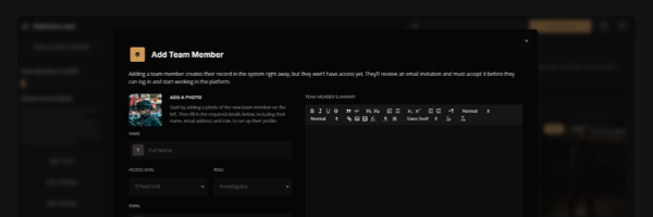
Add team workspaces and trackable field units with active, inactive, and streaming status. Share phone location and camera streams, record check-ins and observations, and tie personnel activity to incidents and investigations.
1.1.0 - Phones & Webcams
🏁 Completed
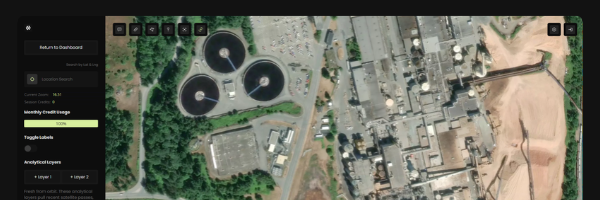
Connect phones and webcams as live sources on the map. Stream field video into the platform so teams can observe locations in real time and attach footage directly to investigations.
1.10.0 - Video & Sensor AI Analytics
Est Completion Date: Feb 2027
Detect vehicles, people, smoke, and unusual activity in video streams and sensor feeds. Let customers configure which detections matter and review results before taking action. Available as a per-camera add-on.
1.8.0 - Commercial Satellite Tasking
🏁 Completed Nov 2026
Request new satellite acquisitions for selected areas through commercial imagery providers. Track task status, availability, estimated cost, and delivery, with finished imagery added directly to your dossiers and watchlists.
1.6.0 - Custom Branding & White-Label
🏁 Completed
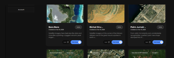
Upload your logo, colors, and custom domain, and the platform becomes yours. White-label branding applies across the login page, dashboards, and team emails, so your team sees only your brand from the first click.
1.4.0 - Advanced Hardware Ingestion
🏁 Completed Nov 2026
Connect security cameras, drones, body cams, and remote sensors as map-based assets. Show position, status, sensor readings, and live or recorded video, with remote commands (when supported).
1.2.0 - Investigation Dossiers & Intelligence
🏁 Completed
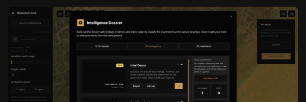
Give each investigation a shared record containing locations, satellite snapshots, live video, photos, notes, timestamps, source references, and a chronological event timeline. Generate draft briefings and reports from that evidence.
1.0.0 - Satellite & Map Intelligence
🏁 Completed
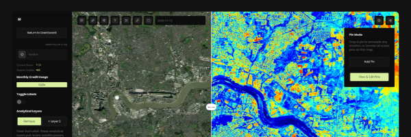
Explore public and private satellite sources including NASA, VIIRS, MODIS, Landsat, Sentinel, ESA, and Planet. Draw areas of interest with multiple pins, measure distances, and compare change in calendar view.
LET'S TALK
assets? Tell us about your
operation and we’ll show you
how Nebulum fits.
OUR NEWSLETTER
USE CASES
Corporate Security
Asset & Site Protection
Critical Infrastructure
Intelligence & Investigations
Political Risk & OSINT
Law Enforcement
Tactical Units
Event & Venue Security
Executive Protection
Field Team Coordination
Remote Guarding
Remote Surveillance
Persistent Site Monitoring
Disaster & Crisis Response
Extreme Operations
CAPABILITIES
COMPANY
@NEBULUM 2026. ALL RIGHTS RESERVED