WE ARE
NEBULUM
Monitor locations, investigate real-world activity, and understand emerging threats and risks by bringing satellite imagery, historical observations, geographic data, and live field video together in one intelligence platform.
Nebulum is a physical world threat intelligence platform.
Earth Observation Agents, Change Detection, Alerts ++
Monitor the places that matter. Understand what changes. Connect satellite imagery, geographic data, and live observations to build a clearer picture of emerging events, evolving risks, and what is happening on the ground.
We build AI-powered systems
for real world threat Intelligence
Combining satellite imagery, live observations, and geospatial
AI into actionable event, threat and risk intelligence

Asset / Site Threat & Change Detection
Identify meaningful changes across locations and time using satellite imagery, geographic data, and machine learning.

Temporal Timeline Analysis & Visual Calendars
Follow the story of a location through time with synchronized imagery and historical context that reveal how events and patterns unfold.

AI-Assisted Intelligence Briefings
Ask natural-language questions about locations, activity, infrastructure, environmental change, or historical trends.

Location-Based Threat & Event Monitoring
Track industrial, environmental, agricultural, construction, and infrastructure activity globally.

Smart Alerts For Monitored Locations
Receive automated alerts when significant activity, anomalies, or environmental changes are detected.

Multi-Layer Intelligence Mapping
Blend satellite imagery, terrain, vegetation, weather, infrastructure, and contextual geographic layers.
Machine Learning & Vision Models
- Classification & Regression
- Anomoly Detection
- Clustering & Forecasting
Surface Inteligence

Area Watchlists & Command Center
Automate earth observation workflows from satellite imagery to actionable environmental intelligence.
Multi-Person Coordination
Collaborative intelligence dossiers
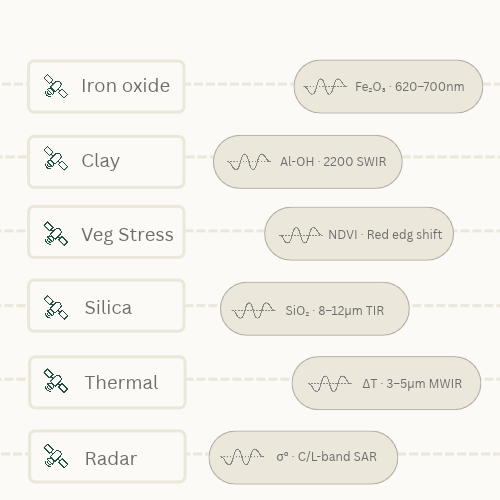
Reveal hidden environmental and material signatures using multi-band satellite spectral analysis.
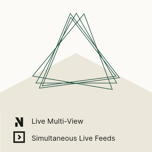
Live Stream Video
Investigate real-world events, verify claims, analyze historical activity.
Custom Data Feeds & Charts
Hi! We’re Nebulum
Monitor remote locations from space to ground with Nebulum. Combine satellite imagery, cameras, sensors, and team intelligence to investigate environmental and human threats, track emerging events, and build collaborative intelligence dossiers. Turn fragmented observations into actionable intelligence and a clearer picture of evolving risks.
Areas monitored ———————————————————–
195+ Areas
Intelligence layers ————————————————
40+
Labs projects ———————————————-
4
WE ARE
NEBULUM
AI-powered geospatial intelligence that connects satellite imagery, cameras, sensors, and field teams to monitor remote locations, investigate threats, detect meaningful changes, and transform fragmented observations into actionable intelligence and compelling visual narratives.
LET'S TALK
We’re building the future of
geospatial event, risk & threat
intelligence.
OUR NEWSLETTER
USE CASES
Disaster & Crisis Response
Asset Protection
Environmental
Agriculture & Forestry
Critical Infrastructure
Political Risk & OSINT
Corporate Security & Threats
Intelligence & Investigations
Geospatial Intelligence
Tactical Units
Law Enforcement
Event Monitoring
Persistent Visual Monitoring
Extreme Environment Ops
CAPABILITIES
COMPANY
@NEBULUM 2026. ALL RIGHTS RESERVED